 Latest-greatest on the fire can be found here (KMGH is still changing the URL) and here (9News is back on the air), and the official Forest Service page can be found here.
The USFS map is probably the most authoritative and informative to go through, and is the one that the various news resources are tending to pull info off of. The news station sites have lots of purty pictures and “ACTION NEWS MAPS!” sort of stuff, though.
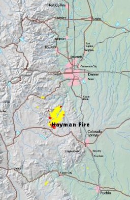
The fire now stretches some 15 miles along the foothills, over 90k acres, and is so large it’s being fought on separate fronts as two different fires. It remains no more than 5% contained.
Skies up here have been pretty and blue and smoke-free, but the southern horizon is a brownish-grey mass of darkness, looming and ominous.
No danger up here yet (still). But it’s pretty amazing to watch.