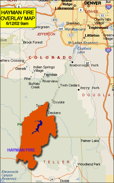
 Best map I’ve found so far (via 9News) of the Hayman fire and where it sits viz us.
I work just above the “e” in Lakewood (at the top of the map). I live just below the “V” in Greenwood Village (upper right corner). It’s about 35-40 miles from there to the fire line, but this provides a nice clear picture of the major municipalities. The map is 24 hours old, of course, but the general dimensions are correct.
Most of the action, due to the weather and wind, is down in the Teller Co. area.
More news here and here. They’re now saying 70-90 days to contain it, let alone put it out (which may have to wait for the rainy season). Yeesh.
53 view(s)